
How to Use Drone Technology to Evaluate Lands for Sale Near Bucharest
In recent years, drone technology has emerged as a revolutionary tool in many sectors, including real estate. The ability to capture high-quality aerial images, engage in precise land mapping, and analyze geographical data makes drones an invaluable asset for evaluating lands for sale. This is particularly relevant in rapidly developing areas such as Bucharest, Romania’s vibrant capital, where real estate opportunities abound. This article explores various applications of drone technology to effectively evaluate lands near Bucharest, providing real estate professionals, developers, and investors with cutting-edge strategies to enhance their acquisitions.
The Role of Drone Technology in Real Estate Evaluation
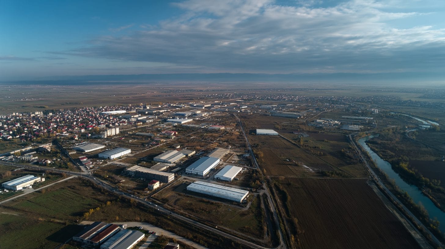
Drone technology offers a myriad of advantages when it comes to land evaluation. Equipped with high-resolution cameras, drones can provide stunning aerial views, highlighting the land’s features, boundaries, and surrounding infrastructure. These images allow potential buyers to gain a comprehensive understanding of the property from a bird’s-eye perspective, which is especially beneficial in evaluating larger plots of land that may not be easily accessible.
Moreover, drones can capture and compile data through various methodologies, such as photogrammetry and LiDAR. Photogrammetry is an advanced technique that processes images taken from multiple angles to create detailed 3D maps of the terrain. In contrast, LiDAR (Light Detection and Ranging) uses laser pulses to measure distances, resulting in high-accuracy elevation models. Both methods are crucial for obtaining accurate topographical data, ensuring investors and developers are equipped with the information needed to make informed decisions.
Understanding Bucharest’s Real Estate Landscape
Bucharest has witnessed a significant transformation over the past years, with a growing demand for residential and commercial properties driven by urban expansion and economic growth. The city’s strategic location and connectivity make it a prime destination for investors looking to capitalize on land for sale. However, evaluating properties in this competitive market requires a precise understanding of various factors, such as zoning regulations, environmental conditions, and the potential for future development.
Using drone technology not only streamlines the evaluation process but also provides crucial insights into when and where to buy land near Bucharest. By capturing data on vegetation, soil type, and potential obstacles, drone technology helps assess the viability of the land for intended uses, such as residential development or commercial projects.
Steps to Evaluate Lands Near Bucharest Using Drone Technology
1. **Planning and Preparing for the Drone Flight**
Before launching any drone for surveying, it is important to establish a clear plan. This includes obtaining the necessary permits for drone operations in Romania, ensuring compliance with local regulations, and deciding on the specific objectives of the survey. Is the focus on capturing high-resolution images, collecting geographical data, or both?
2. **Conducting Aerial Surveys**
Once preparation is complete, the next step is to conduct aerial surveys of the targeted land parcels. Drones can cover large areas in a short timeframe, allowing for comprehensive reconnaissance. Investors should select specific flight patterns and altitudes optimized for the desired outputs, whether detailed images or high-definition maps.
3. **Collecting Data Using Advanced Sensors**
Investors can equip drones with various sensors depending on their goals. High-resolution cameras are excellent for detailed aerial imagery, while multispectral sensors can provide valuable data on vegetation health or soil properties. This data is vital for assessing the land’s potential and can indicate any environmental concerns that may affect the property’s value.
4. **Analyzing the Data**
Once data collection is complete, the next step is analysis. Using specialized software, investors can generate topographic maps, 3D models, and detailed reports. The interpretation of this data enables stakeholders to evaluate the land’s strengths and weaknesses effectively. Investment decisions can be informed by understanding elevation variations, access routes, and surrounding areas, ensuring accurate assessments.
5. **Integration with Geographic Information Systems (GIS)**
For a more in-depth analysis, integrating drone-acquired data with Geographic Information Systems (GIS) can be highly beneficial. GIS combines various data layers regarding geography, zoning regulations, infrastructure, and more. The resulting insights can provide a comprehensive view of the land’s potential, helping investors tailor their offers to current market conditions.
6. **Sharing Insights with Stakeholders**
Drones not only facilitate data collection but also enhance presentations and communications. Investors and real estate professionals can create visually appealing 3D visualizations or VR tours of the property, further engaging investors and other stakeholders. This can accelerate the due diligence process, making it easier to define investment strategies and close deals.
Maximizing the Benefits of Drone Technology in Land Evaluation
To maximize the benefits of drone technology in evaluating lands near Bucharest, a few strategic considerations should be noted:
– Collaborative Approach: Work with professional drone operators or licensed surveying companies to ensure accuracy, compliance, and safety during aerial surveys. This expertise can significantly enhance the quality of data captured.
– Continuous Monitoring: Consider using drones for periodic assessments of a piece of land over time. Continuous monitoring helps track changes in the landscape, which can affect land use plans or appraisals.
– Keeping Up with Technology Advancements: The drones and imaging technologies are evolving rapidly. Investing in new technologies or updates ensures that evaluations remain modern, precise, and effective.
Conclusion
In conclusion, drone technology offers immense potential for evaluating lands for sale near Bucharest. By leveraging high-resolution data collection, advanced mapping techniques, and geospatial analysis, real estate investors, developers, and professionals can make informed decisions, identify lucrative opportunities, and mitigate risks. The integration of drone technology not only enhances traditional methods of land evaluation but also repositions Bucharest’s real estate landscape. As urban development accelerates, embracing drone technology provides a strategic advantage in one of Eastern Europe’s most dynamic property markets. With the right approach, stakeholders can capitalize on the many opportunities available, driving growth and success in their endeavors.
In summary, the implementation of drone technology to evaluate lands near Bucharest is a forward-thinking strategy that can yield significant returns for property investors and developers alike.
Interested in Land Investment in Romania?
We specialize in high-yield land and property opportunities for serious investors.
VIEW OUR CURRENT PORTFOLIOSecure your investment with Land For Investors.
Published: April 19, 2025