
How to Use Drone Surveys to Monitor Land Developments Near Bucharest
In recent years, Bucharest has witnessed a significant surge in urban development, necessitating innovative solutions to track and monitor these transformations efficiently. One of the most groundbreaking advancements in this domain is the utilization of drone surveys for land developments. This technology offers a range of benefits, from enhanced speed and accuracy to reduced costs. As stakeholders in urban planning, construction, and real estate development seek to stay ahead of the curve, drone surveys for land developments in Bucharest have emerged as a vital tool. In this comprehensive guide, we will explore the ways drone surveys can be implemented to monitor land developments in and around Bucharest, along with the benefits and challenges associated with this technology.
Understanding Drone Surveys
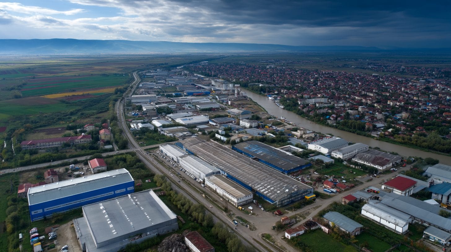
Drone surveys leverage advanced technologies, including aerial imagery and Geographic Information Systems (GIS), to capture high-resolution images and data from above. Equipped with various sensors and cameras, drones can collect data quickly and efficiently, providing insights that traditional surveying methods may not deliver. This process involves flying a drone over a designated area, allowing it to gather data in real time, which is then processed to create maps, 3D models, and other valuable outputs.
The Role of Drone Surveys in Land Developments
As land developments in Bucharest progress, stakeholders require consistent and accurate monitoring to ensure compliance with regulations, assess project timelines, and make informed decisions. Drone surveys can facilitate these needs through several applications:
1. Site Mapping and Analysis: Drone surveys produce high-quality orthomosaic maps and 3D terrain models, allowing developers and urban planners to visualize landscapes accurately. These tools help in analyzing topographical features, vegetation, and existing structures, providing essential insights into how best to utilize the land.
2. Progress Monitoring: Projects often face setbacks due to unexpected challenges or delays. Drone surveys enable project managers to track progress continuously by comparing current conditions against planned developments. This real-time monitoring helps identify any discrepancies early on, allowing for prompt interventions.
3. Volume Calculations: For projects involving earthmoving or material stockpiling, precise volume calculations are essential. Drones can generate detailed models of the site to calculate material volumes, ensuring budgets remain intact and reducing the risk of costly overruns.
4. Compliance and Inspections: Governing authorities often impose strict regulations on land developments to ensure safety and environmental integrity. Drone surveys enable rapid inspections of construction sites, facilitating compliance verification without extensive manpower or prolonged downtime.
5. Marketing and Stakeholder Engagement: High-resolution visuals captured through drone surveys can significantly enhance marketing efforts for real estate developments. Aerial imagery can be used in brochures and online platforms, providing a captivating perspective that can attract potential buyers and investors.
Benefits of Using Drone Surveys for Land Developments in Bucharest
The integration of drone surveys into land development projects around Bucharest presents numerous advantages:
1. Cost-Effectiveness: Traditional land surveying can be time-consuming and expensive, involving extensive labor and equipment costs. Drones streamline this process, reducing overall expenditure while delivering timely and accurate data.
2. Time Efficiency: Drone surveys can cover large areas in a fraction of the time it would take for human surveyors to do the same. This efficiency accelerates project timelines, allowing for faster decision-making and implementation.
3. Enhanced Accuracy: Drones capture images and data with remarkable precision, minimizing errors associated with manual surveying. This accuracy is crucial for critical measurements, ensuring that developments are built as per specifications.
4. Safety: Conducting traditional surveys can pose safety risks, particularly in hazardous or difficult-to-access locations. Using drones mitigates these risks, allowing for data collection from a safe distance.
5. Environmental Impact: Drones have a reduced ecological footprint compared to traditional surveying methods. Their ability to collect data without disturbing the land significantly contributes to sustainable development practices.
Challenges Associated with Drone Surveys
While the benefits of drone surveys for land developments in Bucharest are substantial, there are challenges associated with their use:
1. Regulatory Compliance: The operation of drones is governed by specific regulations set forth by the Romanian government and European Union aviation authorities. Operators must ensure compliance with these regulations, particularly regarding flying altitude and proximity to urban areas.
2. Data Privacy Concerns: Capturing aerial images may raise privacy issues among citizens, necessitating the implementation of protocols to protect sensitive information while adhering to legal guidelines.
3. Technological Proficiency: Effective drone surveying requires skilled operators proficient in piloting drones and interpreting data. Adequate training and expertise are necessary for maximizing the potential of this technology.
4. Weather Dependencies: Adverse weather conditions can hinder drone operations, affecting the scheduling and frequency of surveys. Projects may need contingency plans to accommodate potential weather-related delays.
Implementing Drone Surveys for Land Developments
To successfully integrate drone surveys into land development projects near Bucharest, stakeholders can follow these steps:
1. Identify Objectives: Stakeholders should clearly outline their objectives for using drone surveys, whether for site mapping, progress monitoring, or compliance verification.
2. Choose a Qualified Provider: Select a reliable drone survey service provider with experience in land developments and compliance with local regulations. Review their portfolio and past work to ensure their expertise aligns with your project needs.
3. Prepare for the Survey: Collaborate with the chosen service provider to plan the survey effectively. Identify the area of interest, specify required outputs, and coordinate logistics such as permits and timing.
4. Conduct the Survey: The drone operator will deploy the drone to gather aerial data, which will be processed into the desired outputs, such as maps or volumetric calculations.
5. Analyze and Implement Findings: Stakeholders should analyze the generated data to derive insights and make informed decisions. This analysis will guide project management and enhance collaboration with other stakeholders in the development process.
Conclusion
As Bucharest continues to evolve with rapid urban development, the adoption of drone surveys for land developments has become indispensable. This innovative technology promises to revolutionize how stakeholders monitor projects, ensuring efficiency, accuracy, and compliance. By leveraging drone surveys, developers, urban planners, and related professionals can gain a competitive edge in their endeavors, fostering sustainable growth while effectively navigating the complexities of modern development. The future of land development in Bucharest is bright with the integration of drone technology, marking a significant step toward enhanced urban planning in Romania. For stakeholders aiming to capitalize on the benefits of drone surveys in land developments around Bucharest, timely implementation and strategic planning are fundamental to success.
Interested in Land Investment in Romania?
We specialize in high-yield land and property opportunities for serious investors.
VIEW OUR CURRENT PORTFOLIOSecure your investment with Land For Investors.
Published: April 22, 2025